


Brooksbrae is one of New Jersey’s greatest treasures. Exploring here should be a must.
Read More


Graffiti Highway
This is going to be a different one than usual. The Graffiti Highway is no more. As of writing this, the private owner of the road has started the process of covering up the road with dirt to prevent people from visiting the site. You can no longer visit this place, but I wanted to cover it because of what it meant to a lot of people.
Centralia, Pennsylvania was once a bustling coal town with upwards of 2,500 people. Now only 7 people call this place home. You see, back in the 60s a massive fire started in the coal mines and it still burns to this day. This fire has created sinkholes and giant cracks in the ground and roads. Perhaps the most famous of those roads is the Graffiti Highway, an abandoned stretch of Pennsylvania Route 61 that has become a canvas for artists of all sorts.
I had the pleasure of visiting the Graffiti Highway back in December of 2019. I was on a road trip with my good friend Ukiah and it was actually his idea to go through here. We got lucky showing up in mid-December as there was no snow and warm weather. The Highway was really spectacular. There were paintings ranging from simple names and dates to complex thoughts and high-detail sprays. Everything that could possibly be tagged, was. Not a single spot on the road was the original asphalt anymore. It was coated in several layers of paint.
Nowadays the town is only about 10 buildings and a cemetery, it also has a lot of new forest growth and dirt roads and trails for off-roading. You’ll still be able to explore those trails and see the trees and rocks that have been painted but you won’t be able to see any of the highway. Centralia is still a cool place to see what once was and is an important part of Pennsylvania history.
If you want to see a really good in-depth break down of the town as well as some shots from the road, check out this video by Bright Sun Films, Abandoned-Centralia.


Beaver Valley
Hidden away on the state line between Pennsylvania and Delaware, lies a spectacular park called Beaver Valley. Owned by the National Park Service, it has 1,100 acres of pastures, fields, forested hills and stream valleys. That’s simply too much land to cover so today, we will be talking about the section known as the Woodlawn Short Loop.
The Woodlawn Short Loop is home to many cool things. It has a stream running through it that provides juxtaposition to the forest around it. That stream starts out small and simple on the east end and becomes a series of rapids and waterfalls on the west end. At around the 12 O’clock section of the trail sits some English Quaker ruins that are from the 19th century.
This section sits just north of Brandywine Creek State Park in the area right behind Hy-Point Dairy Farms. The easiest parking lot to access the Quaker ruins and waterfalls is on Beaver Valley Road across the road from Cloverleaf Stables. There will be a National Park Service sign to let you know exactly where but the sign is on the wrong side of the road.
This is not the hardest area to hike. I’d say the only difficult thing about hiking here is the fact that none of the creek crossings have bridges. You have to either rock hop or get your feet wet. The streams are only about 6 inches to a foot deep, so it is nothing crazy. With the high number of stables and farms in the region, you do have to watch out for horses and horse excrement. You should also keep your eye out for cyclists and other hikers as well.
Beaver Valley was recommended to me about 2 weeks ago and although I have only been a handful of times, I really want to go back. From the moment I set foot on the trail, I knew this area was unlike any place in Delaware that I had been to before. There is a feeling to this place that cannot be named. The best description of that feeling is a sense of discovery, like there’s something to find around each bend and valley.
For more information on Woodlawn Short Loop, check out the AllTrails page. For more information on Beaver Valley, here is the National Park Service’s website.


Snake Island
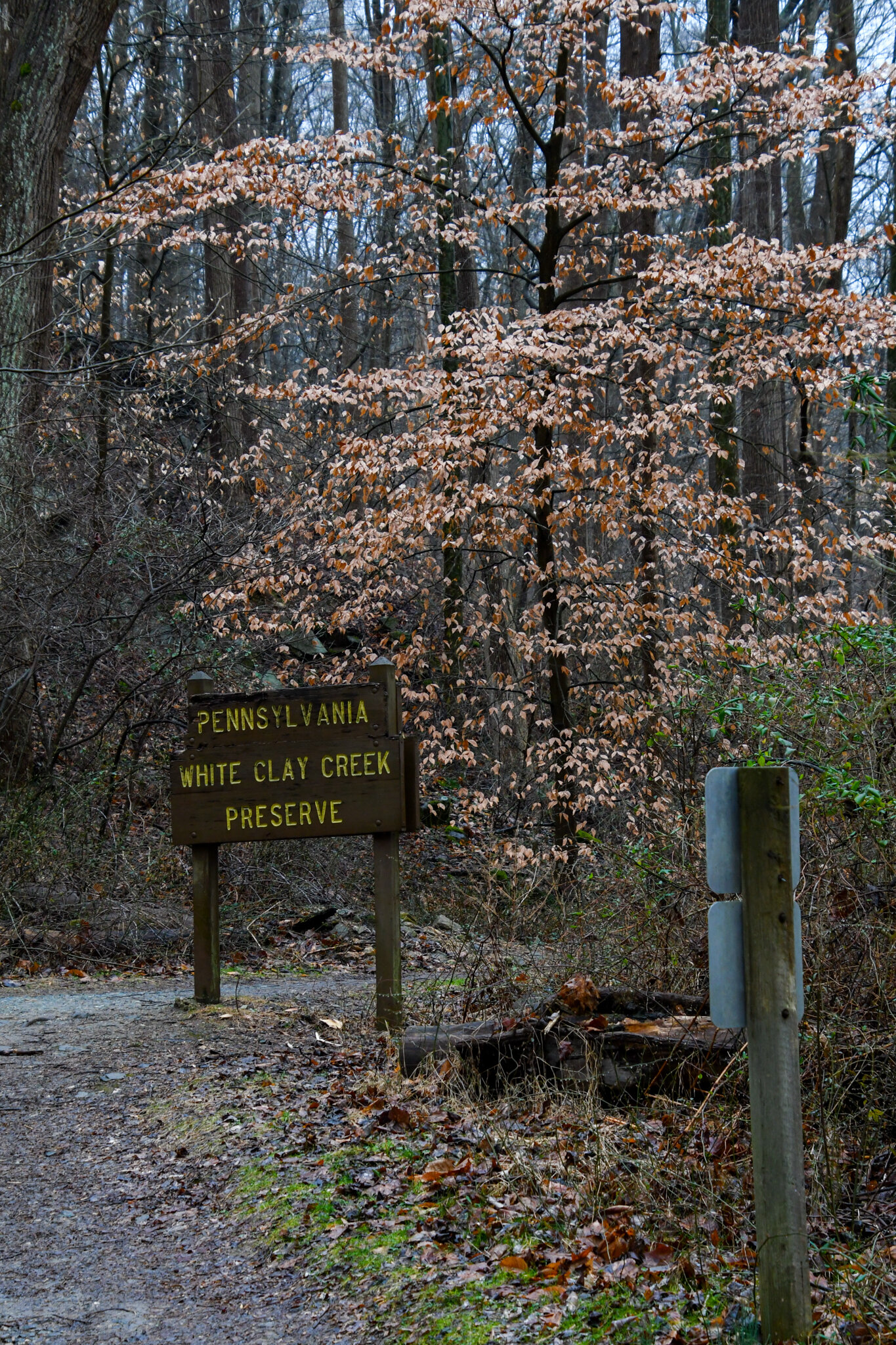
Follow the White Clay Creek upstream into Pennsylvania on the Nature Preserve Trail and you will come across Snake Island. The remains of an old railroad bridge have created an island in the middle of the creek that is typically inhabited with snakes. Don’t worry, they aren’t venomous, and the remains of the bridge are still a cool area to explore without visiting the center island.
Ophidiophobia, the fear of snakes, is one of the most common phobias in the world. When you consider how dangerous snakes can be, you’d be crazy not to fear them. Thankfully, in Delaware we don’t have many dangerous snakes, and the ones here at Snake Island are no different. Northern water snakes are the snakes that call this island home. They are non-venomous and quite passive, however, they can still bite you so be careful around them.
I discovered Snake Island with some friends back in 2017. The goal for the trip was to find out if there was anything cool on that trail. Turns out, there was. We took some time to explore the entire Island and somehow didn’t notice any of the dozen snakes slithering around until we had been there for a couple minutes. It was a little scary but after learning what types of snakes they were, the area felt like a home and I was just a guest being invited in. I have been back here several times to take photos of the snakes and watch them from a distance. Seeing how they live in peace and harmony with their colony is a wonderful experience.
It is not very difficult to get here until the final 15 feet or so. Park at the Chambers Rock Parking lot in White Clay Creek State Park and hike north for about a ½ mile. Be aware that since this is a State Park, there is a $4 daily pass fee for in-state vehicles and an $8 out-of-state vehicle fee. The path is well worn and flat so the only issues you will come across are going to be mud and mosquitoes. Don’t be alarmed when you cross into Pennsylvania, you will only be in PA for about 50 feet. You’ll know that you’re here when you hear the rushing water and see the old bridge supports crossing the creek. This is where the final 15 feet is, you then have to go down a steep but short embankment and rock hop some small boulders. After you do that, you’ll be looking out at Snake Island. If you want to see a nice video showing the area, I found this one on YouTube. That middle area with the supports is Snake Island.
Having been here in almost every month, there is no real best time to go for an overall experience, rather there are better times to go for specific things. If your aim is to see snakes, then you should try and go from April to June. That is the time when the northern water snakes are most active, it is also the time when they breed so be extra careful. The wintertime is the most peaceful time to go. Go just after a rainstorm or when it snows, the entire area will have a pristine glow to it that it doesn’t get any other time of year.
I cannot recommend taking young children or pets here. However, a responsible and careful adult should have no problem maneuvering the island and trail easily. Please remember to keep our parks clean and to not disturb the wildlife in the parks. These snakes are for viewing and not playing. Here is a map of White Clay Creek State Park. Also, here is a link to the Delaware State Park website, you can find more info on White Clay, as well as other state parks in the area.